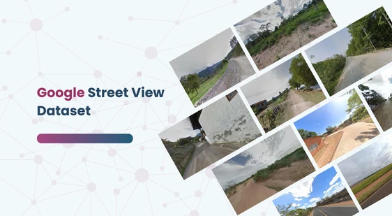
This dataset comprises 10,000 diverse outdoor images sourced from the Google Street View API. It is specifically curated to assist in various machine learning and AI applications requiring real-world outdoor imagery.
Download Dataset
Content Details:
Images: 10,000 images, each sized at 640×640 pixels.
Coordinates: A coords.csv file containing precise latitude and longitude information for each image, ensuring accurate geographical representation.
Sources: All coordinates and images are directly obtained from Google Street View, guaranteeing high accuracy and reliability.
Additional Features:
Diversity: The dataset includes images from various geographical locations, capturing a wide range of environments and urban settings.
Applications: Ideal for projects involving geospatial analysis, urban planning, environmental monitoring, and computer vision tasks like object detection and scene recognition.
Quality Assurance: Rigorous checks ensure that the data is free from inconsistencies and errors, providing a dependable resource for research and development.
Contact Us
Quality Data Creation
Guaranteed TAT
ISO 9001:2015, ISO/IEC 27001:2013 Certified
HIPAA Compliance
GDPR Compliance
Compliance and Security
Let's Discuss your Data collection
Requirement With Us
To get a detailed estimation of requirements please reach us.